Field survey of Ta-taki Waterfall and Agarie Coast
6/24 2023
On June 24, 2023, we went to the Ta-taki Waterfall in the Henan River and the Agarie Coast for a field survey.

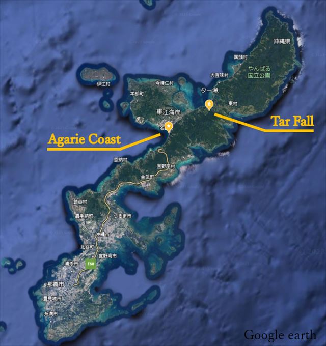
Location map of the Ta-taki Waterfall and Agarie Coast
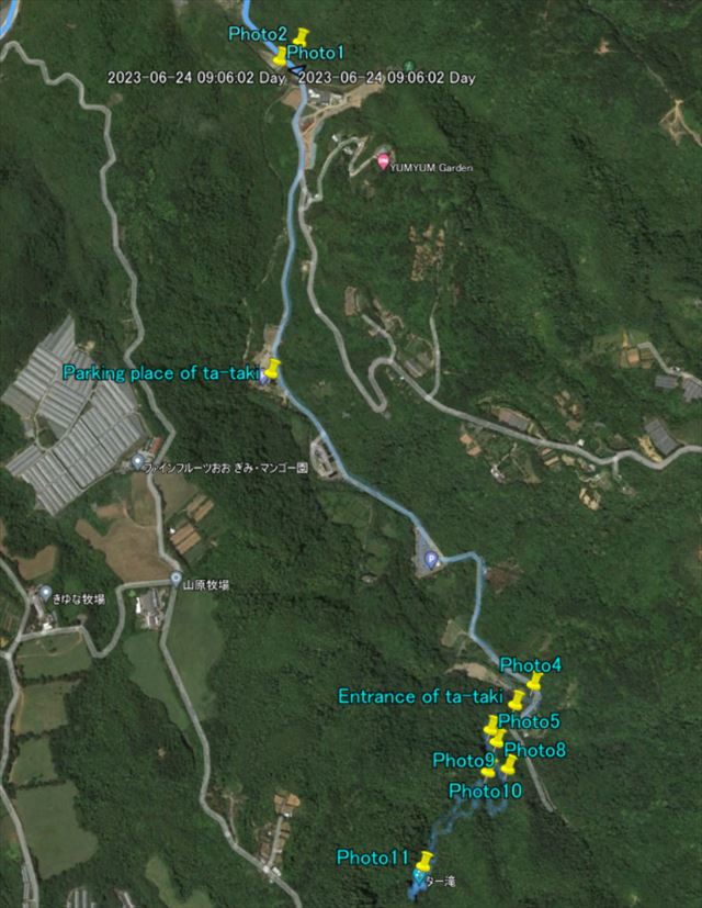
The Ta-taki Waterfall field survey route is shown below.

Ta-taki Waterfall Route Map
There was a rubber weir on the way to Ta-taki Waterfall[Photo 1]. The rubber weir can be tipped over by expelling the air inside it. Normally, the weir is raised to facilitate water intake, but during flooding, the weir is tipped over to lower the water level upstream.

Photo 1 Rubber weir
A fishway was installed next to the weir to allow fish to move up and downstream of the weir.

Photo 2 Fishway next to rubber weir
We parked our cars at the parking lot of the Henan River Ta-taki Waterfall and walked along the river.

Photo 3 At the parking lot of the Henan River Ta-taki Waterfall
After a short walk, there was a bend secton in the river. Sand and gravel have accumulated on the inner bank side, and the river bottom is deeper on the outer bank side. At the bend section, centrifugal force acts on the flow. Since the flow velocity is greatest near the water surface, the centrifugal force is greatest near the water surface, and the flow near the water surface is directed toward the outer bank by the centrifugal force. The force of this current causes the river bottom to flow in the opposite direction toward the inner bank side. As a result, sand and gravel on the river bottom move from the outer bank side to the inner bank side, deepening the outer bank side and forming a sandbar on the inner bank side.

Photo 4 Sediment accumulation on the inner bank side
A further walk takes us to the entrance of Ta-tak Waterfalls, from where we will walk through the river.
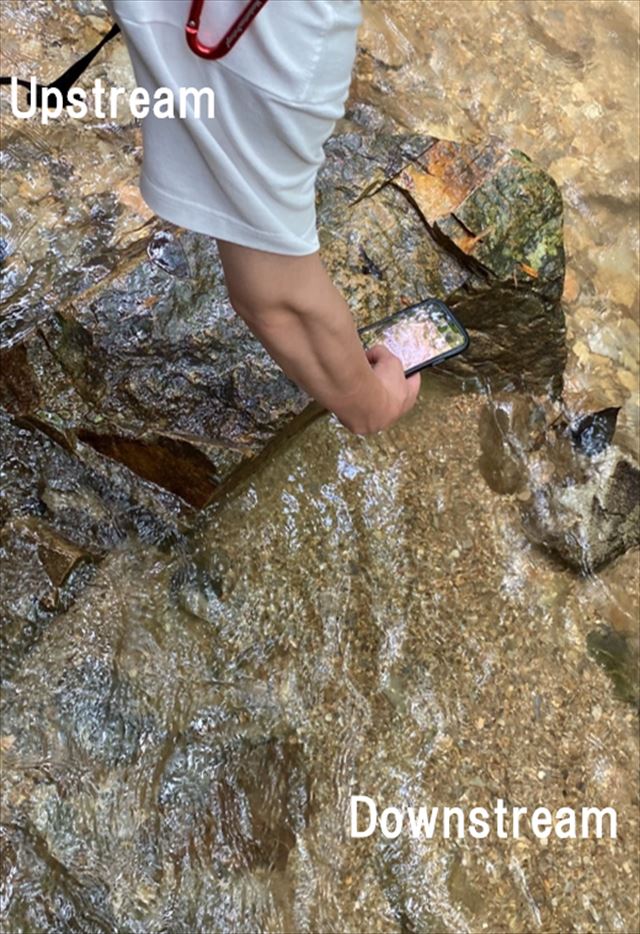
There were large stones in the riverbed. It was observed that downstream of the large stones, small grain size sand and gravel were deposited, while upstream of the large stones, large gravel was deposited. While upstream of the large stones, the fast flow makes it difficult for small sand and gravel to be deposited, small sand and gravel are deposited downstream of the large stones because the flow is slower downstream of the large stones.

Photo 5 Large stones in the riverbed

Photo 6 Downstream of the large stone

Photo 7 Upstream of the large stone
There is a clustering of large stones on the river bed, forming a natural dam.

Photo 8 A clustering of large stones forming a natural dam.
In areas where the flow is gentle and the water depth is significant, even small particles are less likely to be washed away, so the riverbed is composed of small particles.

Photo 9 Sedimentation area for small particles.
In the upper reaches near the waterfall, there were numerous large rocks similar to Photo 10.

Photo 10 Large stone.
We have arrived at the Tar-taki Waterfall.
Water was plummeting fiercely from a height of approximately 15 meters, sending spray into the air. Many people were enjoying swimming in the pool at the base of the large waterfall."

Photo 11 Ta-taki waterfall
The Agarie Coast has constructed three offshore breakwaters extending from the coast and artificial reefs, aimed at wave control and coastal preservation. To assess the status of these installations, a field survey of the Agarie Coast was conducted. The map below shows the route for the current on-site survey of the Agarie Coast.

Route Map of the Agarie Coast
Near the breakwaters, there was a significant accumulation of sand, and right next to the sandy beach, there was an almost vertical seawall.

Photo 12 The sandy beach and the vertical seawall.
The area around the breakwater located in the left part of the route Map was covered with large rocks, including seawalls and breakwaters.

Photo 13 Breakwater covered with natural stones.
In order to prevent coastal erosion, gravel bags were installed. Several of these gravel bags were tied with ropes to rocks of similar size to the gravel bags themselves.

Photo 14 Gravel bags
Artificial reefs are structures installed beneath the water surface at a distance from the shore, designed to induce wave breaking by reducing the water depth to help mitigate coastal erosion. During the on-site survey, we did not observe significant waves and wave breaking on the artificial reef.

Photo 15 Submerged artificial reefs
We were able to visit the structures aimed at wave control and coastal preservation on the Agarie Coast. We learned that the combination of various structures such as artificial reefs, breakwaters, and seawalls is being utilized to effectively protect the coastline.

Photo 16 Group photo at the Agarie Coast
