We went to the field survey of Asja River.
7/7 2022
The Ajagawa River runs from Shuri Ishimine-cho, Naha City, flows southwest through a residential area, flows through Sueyoshi Park, and then joins its tributaries, the Takushigawa River and the Mekaru River, before reaching the East China Sea. The flood water level in the Ajagawa River near the Shinkaikibashi bridge, where a water level gauge is installed, frequently exceeds the level of flood risk, so we conducted a field survey from the upstream end of the Ajagawa River to Sueyoshi Park to check the river conditions. The figure below shows the route of this field survey.

Root Map

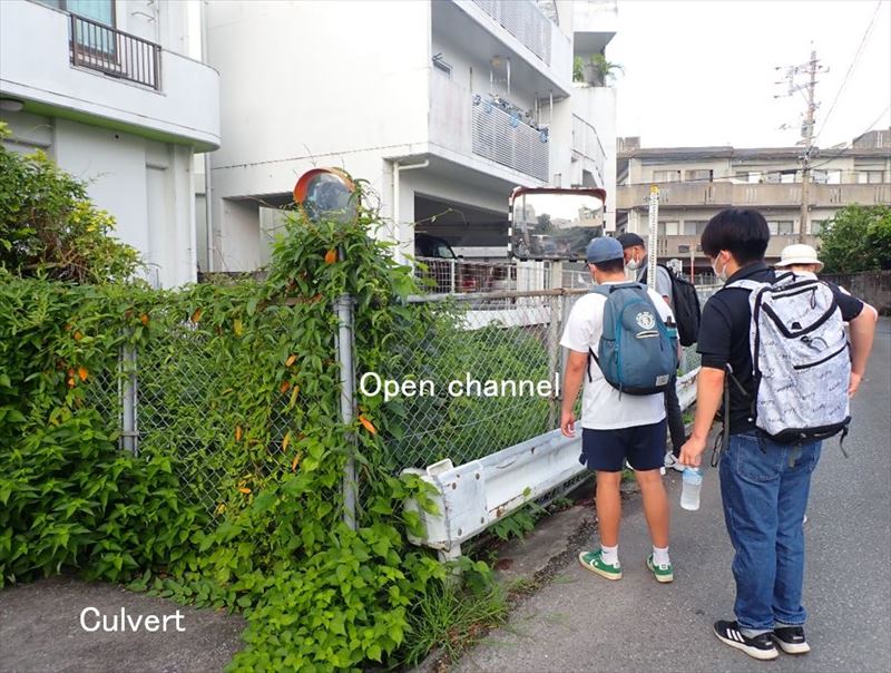
Photo 1 Upstream end of Ajagawa River changing from culvert to open channel.

Photo 2

Photo 3
The river runs through a residential area. Photo 4 shows a point about 600 m from the upstream end of the river. Water level markers were painted on the wall and a water level alarm system was installed (Photo 5).

Photo 4 Water gauge.

Photo 5 water-level warning device.
Photo 6 shows that the river is still narrow and the bridge height is relatively low, and that the flow rate is low.

Photo 6
At a further distance of about 180 m from the water level gauge (about 850 m from the upstream end), the river width appeared to be virtually unchanged (Photo 7). Visual inspection of the approximate depth and velocity of the stream revealed a depth of about 3 cm and a velocity of about 0.5 m/s.

Photo 7
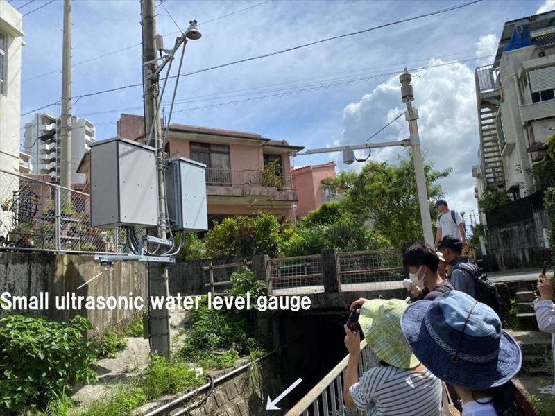
Photo 8 shows a point about 1.1 km from the upstream end. This is the location where the water level sensor was installed, and a small water level sensor shown in Photo 9 was attached. The Okinawa Prefecture River Status System allows the water level at this point to be checked every 10 minutes.

Photo 8 Shinkai Bridge Water Level Gauge.

Photo 9 Compact IoT water level sensor.
Photo 10 shows that the river has become wider (approximately 3 m) and the bridge height from the river bottom has been raised. At a point about 150 m further downstream from the water level sensor installation point (about 1.3 km from the upstream end), a camera was installed as shown in Photo 11. The latest live image looking upstream of the Shinkai Bridge can be viewed on the Okinawa Prefecture River Status System.

Photo 10 Simplified cross-sectional survey at the water level gauge point.

Photo 11 Shinkai Bridge live camera.
At a distance of about 1.7 km from the upstream end, the river flowed from the residential area to the main street of Prefectural Road 241. Photo 12 shows the upstream view from the Showa Bridge on Prefectural Road 241, where river improvement work was being carried out at the curve. On the other hand, as shown in Photo 13, the downstream side was straight and no improvement work was beening done.

Photo 12 View upstream from Showa Bridge.

Photo 13 View downstream from the Showa Bridge.
The river reaches Sueyoshi Park. The slope of the Aja River steepens abruptly at Sueyoshi Park, with a large drop of about 60 m from the upstream point to the downstream point of Sueyoshi Park. Here, as shown in Photo 14, the river was like a mountain river with little maintenance and numerous huge stones. The river in the park also provides habitat for many species.

Photo 14 The river in Sueyoshi Park.

Photo 15 By the river in the Sueyoshi Park.
After exiting the park, the river again flows through a residential area. Photos 16 and 17 show the upstream and downstream views, respectively, from the Sueyoshi Bridge in the residential area. The river is quite different from the upper reaches of Sueyoshi Park, and the width of the river is considerably wider.

Photo 16 View upstream from Sueyoshi Bridge.

Photo 17 View downstream from Sueyoshi Bridge.
From the upstream end, including the area near the Shinkai Bridge where the water level gauge is located, to the area near Sueyoshi Park, the river was generally narrow and had a well-developed concrete revetment, but once it entered Sueyoshi Park, the gradient suddenly became steep and the river became natural, like a mountainous area, and after passing Sueyoshi Park, the gradient became slow again and the river width was much wider compared to the upstream area. Although it was a short field survey of approximately 5 km, we were able to see a variety of river conditions.
